Our Communities
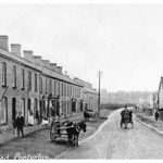
The Community of Pontyclun consists of a number of small villages clustered around the bustling town of Pontyclun
Most of the development has been since 1850, driven by the arrival of Rail and the industrial revolution. This powered the growth of the population with new houses, shops and industry.
Pontyclun
The 1841 – 42 tithe map of the Pontyclun/Miskin area shows just 30 farms ranging from 20 to 200 acres in size, a corn mill and small cottages at River Row.
The name Pontyclun has been in official use since 1893. The name derives from the bridging of the River Clun as it joins the River Ely. The source of the Clun is at the Garth above Pentyrch and it flows along a broad plain to its confluence with the River Ely before that river meanders around the town of Pontyclun. The Clun River has been referred to at various times as the Clune, Cloune or Clown. There are also Clun Rivers in Pembrokeshire and Montgomeryshire. The word Clun is another variation on the Celtic words Glyn, Glan and Glen which refer to relatively broad glacial valleys’.
It was the influx of workers for the iron ore and coal industry together with the coming of the railway during the 1850’s that changed the area for all time. The Coedcae Colliery (first listed in 1856) and the Bute iron ore mine (which opened in October 1852) were the catalyst for the population growth.
The new industries attracted labour from many parts of Wales and the rest of the United Kingdom, Cornwall in particular. The way of life changed from agricultural to industrial. The proportion of families using Welsh in their daily life diminished
By 1870 the industries of the area had been expanded by the coming of the Ely Tin Plate Works (1872), The Llantrisant Pipe and Pottery Works (before 1890) a railway wagon works (in 1880s) and The Steam Joinery Company (before 1880). The needs of the workforce brought about the building of School Street and Llantrisant Road which were among some of the earliest houses in the area, along with the National School built in School Street, c. 1878.
The Bute and Windsor Hotels were built in the 1870s, a cinema – Studt’s, opened in 1913 (rebuilt in 1931 opening with “talkies”)
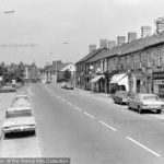
Development of the town continued (and does so today). Electricity arrived in 1920, street lighting in 1925; shops and businesses started and a thriving town centre was built
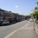
Pontyclun continues to prosper despite the closure of the pits and ore workings, which had a drastic effect on the area. Commuting to Cardiff and the Vale has also made Pontyclun the ideal location so housing has expanded as a result.
You can find more information about Pontyclun at the RCT CBC History Trail here
Information about the railway in Pontyclun can be found here
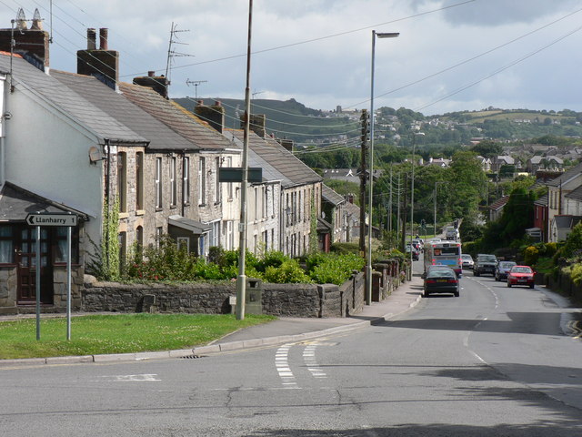
Miskin
The census of 1841 shows a total population of 31 in five households, including a farmer, miller, shopkeeper, dressmaker shoemaker and labourer.
At this time the hamlet was known as ‘New Mill’, reflecting the fact that a new mill had been built here in the 1600s. The name Miskin was later adopted by Judge Gwylim Williams to reflect its more ancient roots.
By the 1861 census New Mill had become a village. Its population had increased to 83 in 17 households. In addition to the farmer, miller, shoemaker and labourer, we now find 17 iron ore miners. The opening of the Bute and Mwyndy iron ore works during the 1850s had had a dramatic impact on New Mill’s development and it continued to do so. Iron ore mines were worked as open cast quarries during the industry’s early history
By 1871 over half of New Mill’s iron ore miners had emigrated from Cornwall following the collapse of tin mining there in 1866. The population was then 144.
More information can be found on Miskin at the RCT History trail site here
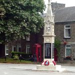
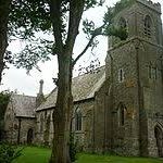
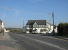
Groesfaen
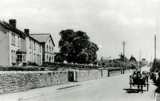
The village began as a hamlet on the Cardiff to Llantrisant road. Historically it was also on the Penhrys Pilgimage route. The churchyard has the base of an ancient cross in it and this is believed to be from one of the route markers.
The opening of the Bute & Mwyndy iron ore works during the 1850s had a huge impact on the small hamlet of Groes Faen. The census of 1861 shows that Groes Faen had become a village. Its population was 83 people in 17 households, of these 83 residents 17 were iron ore miners, meaning that on average each household had 4.9 residents with one being an iron ore miner. The village centre was the pub The Dynefor Arms, and the cottages surrounding it.
Brynsadler
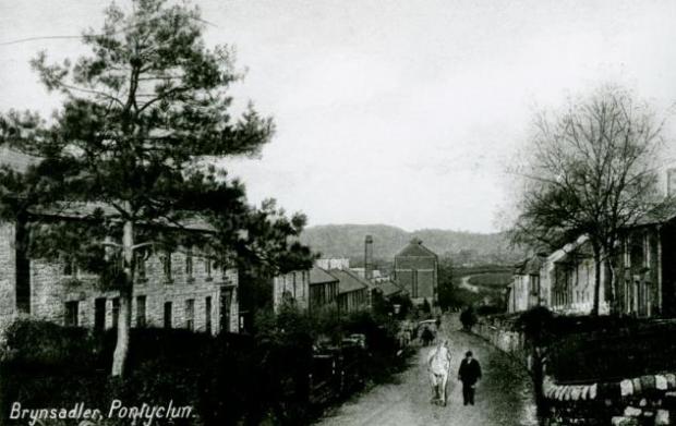
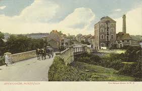
The A4222 main road to Cowbridge runs through the village; locally it is known tautologically as ‘Brynsadler hill’.
In common with most of the are there was very lttle here before the 1870s. The tithe map of 1840 shows only one house south of the River in what is now the centre of the village. By 1871 there were 38 houses with 162 residents
The most likely source of the name is that it is derived from the house of Rees Thomas who was a Saddler in the area in the 18th Century – his house was Ty Saddler hence, Brynsadler (hill of the Saddler). Indeed for a time the village was known as Brynsaddler
Brynsadler used to be home to the Crown Buckley brewery housed opposite the village pub, the Ivor Arms. The brewery was bought by S A Brain and eventually relocated to Cardiff. The brewery and brewery houses were demolished and a housing estate called “Clos Brenin” replaced it.
Brynsadler also housed a chapel, called Capel Zion, located opposite the post office. It closed down and was converted into housing accommodation.
Reverend William Williams had a school here in the 19th Century
Brynsadler is listed in the Understanding Welsh placenames website here
More information
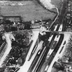
We have an archive of aerial photographs of the community which can be found here. The Coflein site also have many more.
More information about places including their history, maps, aerial photographs and more can be found at the Royal Commission on the Ancient and Historic Monuments of Wales website. This also includes details on the various chapels we have in the Community.